Water is continually moving around, through, and above the Earth. It moves as vapor, liquid, and ice. It is constantly changing its form. Water is known by different terms, such as surface water and groundwater, depending on where it is and where it came from. Runoff originates from rain and from melting snow and ice, and replenishes surface waters such as lakes, streams, creeks, and wetlands. It also replenishes groundwater, or the water that collects or flows beneath the surface, filling the porous spaces in soil, sediment, and rocks known as aquifers. Groundwater mineralization can occur, with the water going from fresh to saline. Groundwater often discharges into springs, lakes and rivers, contributing to the surface water’s quantity and impacting its quality.

Athabasca River upstream of Mountain Rapids; Photo Credit: Brian Jackson
What affects water - quality and quantity
Many factors directly and indirectly influence the quality of Alberta’s water. Some natural factors include climate and precipitation, soil type, geology, vegetation, quantity and flow conditions. Human activities on the land also influence water quality. Impacts to water quality can come from both point and non-point sources. Effluent discharge from a municipal waste water treatment plant or an industrial facility, are examples of a point source. Underground activities, such as mining, hydraulic fracturing and steam injection, also have the potential to effect water quality. Non-point sources include activities like agriculture, forestry, intensive recreation within the watershed, or atmospheric deposition, just to name a few. Rain and snowmelt can move materials from the land surface into nearby watercourses, and expose aquifers to potential impacts. Inputs from non-point sources can include sediment, nutrients and toxic contaminants. Certain pollutants originating from urban, industrial and agricultural activities can also be transported long distances by atmospheric processes, and deposited directly onto land and waterbodies within a drainage basin. Acid rain is one of the best known examples of this type of impact. Another is the transport of mercury from Asia to the Canadian Rockies. This long-range transport can also include soil minerals, nutrients and numerous man-made chemicals.
The quantity of water also affects its quality. Increase in quantity from major rains and high-flow events typically wash sediment, nutrients, pesticides, bacteria, and other substances off the land, into rivers, and infiltrate groundwater and aquifers, thereby lowering water quality. Conversely, the less water there is, the lower the capacity of a waterbody to dilute and assimilate wastes. Climate change and increased consumptive demands may decrease water quantity, therefore also affecting water quality in the future. These factors could also influence the flow regime (timing of river flows, stream flashiness, frequency and intensity of peak flows, and more), which could impact the suitability of habitat for aquatic life.
Who is involved in water monitoring
In Alberta, water monitoring in the ambient environment is a collaborative effort led by AEMERA. AEMERA also has many affiliates who carry out monitoring initiatives. Government agencies and university researchers have conducted much of the past scientific investigation of waters, but Watershed Planning and Advisory Councils, industries and municipalities are now active partners in many studies. Volunteer organizations, such as the Alberta Lake Management Society, also play a valuable role in water monitoring in Alberta.
Water monitoring itself
To better understand the cumulative impacts of natural and anthropogenic factors, comprehensive programs looking at water quality and quantity are conducted province-wide. These programs are designed to consider long-term trends, and short-term changes, and ecosystem impacts at both regional and provincial scales.
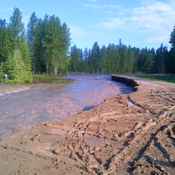
Erosion, Photo Credit: James Rogans
Water quality monitoring
Province-wide
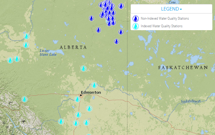
Provincially, lake, river and ground water quality monitoring is conducted to assess long-term patterns over space and time and understand cause-effect relationships. Water monitoring looks at a variety of parameters, using physical, chemical and biological measurements together to describe the overall water quality or health of aquatic ecosystems. The data obtained can be used in a variety of ways, such as assessing safety of Alberta lakes and drinking water for recreational and domestic uses, or contribute to academic research. For example, groundwater quality monitoring is being used to establish and update important condition indicators, such as methane gas and nitrates in groundwater. As issues or knowledge gaps are realized, temporary monitoring initiatives may be implemented provincially, and assessments conducted to determine future monitoring needs.
Regional
To understand regional impacts on water quality, monitoring may be enhanced to look at specific parameters, temporarily or over the long-term. For example, monitoring in southern Alberta often includes bacteriological parameters in areas of intense land use activities (agriculture and urban development). Also, enhanced monitoring occurs in the oil sands area to detect and quantify any biological and ecological impairment resulting from exposure to substances released from development activities. Fish, benthic invertebrates, algae and other biological samples and associated environmental information are collected in the Athabasca River and in several of its tributaries, at wetland sites in the Peace-Athabasca Delta, and in the Steepbank, Ells, Mackay, Muskeg and Firebag rivers.
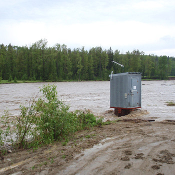
Photo Credit: James Rogans
Water quantity monitoring
Monitoring of the current status and trends in water quantity is conducted for many purposes. Data on lake levels supports operations of water management structures, licensing, and informs on water supply, drought, water quality indicators, recreation, climate change initiatives, interprovincial and international apportionment agreements, and regional planning. Data collected from snow surveys supports water supply outlook and flood forecasting as well as operations of provincial dams and reservoirs. A network of monitoring wells tracks groundwater trends, to understand its occurrence, movement and quality. Tracking of long-term variations in groundwater levels is used to establish baseline regional groundwater levels as well as lower and higher historical limits. Unusual short-term changes in groundwater, such as a sudden increase or a sudden decrease in levels, are also measured.
Results – sharing and uses
Monitoring results are shared in an open and transparent manner with many stakeholders. Not only does this facilitate a shared understanding among Albertans of the condition of Alberta’s waters, the information can be used by decision-makers, including policy developers and regulatory agencies. Provincial and federal government departments and agencies that rely on the monitoring results for management activities include Alberta Environment and Parks, Alberta Agriculture and Forestry, Alberta Health, Alberta Health Services and Health Canada.
Updates of the monitoring results, and associated information, are provided online as they become available. A repository of data and information about chemical, physical and biological variables in Alberta’s lakes and rivers can be found here.
Also, every time a water well is drilled in Alberta, a record is held on the Alberta Water Well Information Database (AWWID). Not only are these records available to the public, the valuable information on these records has provided the foundation for countless scientific studies over the past few decades and will continue to do so into the future.
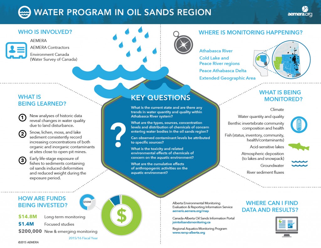
Water Program in the Oil Sands